Themes
- How our stormwater gets to the lake
- Changes in the next few months
- How animals and plants prepare for the winter
Equipment needed
- No cameras (will slow us down too much)
- Thermometer to take temperature of springwater
- Notebook
- Several gallons of water (DT will bring)
- Walking shoes and warm clothes !
Along the way, we're going to pour water from time to time, to see where it goes. Water always runs downhill!
That's why many things on the ground, and on the pavement, end up in the lake.
The lake is a mirror to how we live. If our surroundings are dirty-- then the lake is dirty.
Our route (click photos to enlarge)...

Our goal is to see how stormwater gets to the lake from Wingra School... and what it might pick up along the way. Here's what you'll see and learn at our 18 stops along the way.
#1. "School Creek"
When it hits the ground, rainwater either sinks in, or runs along the surface--where it is called "runoff" or "stormwater."
Let's pretend that the water from around the school comes together to make "School Creek." If you were out in a big storm, you'd actually see a LOT of water flowing. It's fun to walk in the rain, and to see what's happening!
"School Creek" starts in the playground, in the parking lot, and further up Gilmore Street. A lot of water flows across the parking lot, and goes down a drain near Gilmore Street.
Video of parking area during a big storm.
What is getting into the drain? Do you think it will get to the lake?

Where does the water go then? If you look into the nearby stormwater inlet on Gilmore, you can see a blue pipe heading back to the drain at the edge of the parking lot.
 From the inlet on Gilmore, the stormwater heads down Gilmore, under the pavement.
You can see blue arrows painted on the street with "ST,"
which means "stormwater." Just like water on the surface, the stormwater pipes have to run downhill.
"School Creek" goes underground. Here stormsewer pipes are being buried when the Gilmore Street was rebuilt in 2010. They also buried water and sanitary sewer pipes.
#2. Headwaters of "School Creek"
Now we walk uphill, to see where stormwater comes from the north corner of the playground. A blue pipe runs underground from a drain on the playground, to a drain at the edge of the street. Runoff also comes from further up the street.
What is getting into the drain? Do you think it will get to the lake?
A little uphill, there's a spot with bare earth. Let's keep watching this spot during the winter. Do you think soil will run into the lake from here?

#3. Concrete work at the corner of Gilmore & Cross streets
Workers have been pouring concrete, and also cutting it with a saw. Both activities create a white fluid, which ran down the gutter. The workers also discarded leftover concrete on the ground (between sidewalk and street).
The space between the sidewalk and street is called the "terrace." Notice all the concrete waste dumped in the terrace. Is this a good place to grow plants? A bit uphill, nothing much is growing on the terrace. Why?

#4. Dumpster for construction waste
You can see some waste didn't make it into the dumpster. It's in the gutter, and can run to the lake when it rains. Tires from construction vehicles drop mud on the street-- and it then washes into the lake. Builders are supposed to sweep the street at the end of each work day. Nineteen percent of the weeds* in our lakes are caused by construction sites.
#5. Sanitary sewer from Wingra School
 Further down on Gilmore St., you can see a yellow flag on the W side.
This is where the pipe is buried that carries water from the toilets and sinks in your school. Like the stormwater, the pipe has to flow downhill. It flows under the street, and down to a much bigger pipe near the lake.
#6. Hard surfaces and rainwater
We walk down Gilmore, cross Monroe St, then enter the Arboretum.
We're going to pour water on the paved pathway, the dirt trail, and the prairie soil. At each spot, do you think the water will sink in, or run off to make stormwater?

- The ground is rough.
- The plants are thirsty--their roots suck it up, till the plants can't drink any more.
- The soil is like a sponge, partly because other tiny animals are making tunnels.
Any water the plants don't drink trickles underground to the lake. It's filtered and cleaned along the way. Pollutants are eaten by bacteria in the soil.
#7. The council circle
 Before television and the internet, people used to spend a lot more time outdoors.
This place was built in 1935 in memory for someone who died. It's a place to relax and enjoy the outdoors. It's sort of a make believe place-- you can imagine you are at a council of Indian leaders-- deciding something important about your community.
Native Americans built many burial mounds nearby. There are more along the shores of Lake Wingra than anywhere else in Wisconsin. This must have been a special place to them.
#8. Council spring
 Water gushes from the ground in several places here. There are about 15 springs around Lake Wingra now. But there used to be more. Half of them have dried up, because not as much water is getting into the ground--because there's so much pavement everywhere.
Notice how clear the water is. Feel it... it's cold. It comes out the same temperature all year. Why?

A frog lives here. Can you find him?
Most of the pollution that you'd find in stormwater has been filtered out by trickling through the ground. But road salt is one of the few pollutants that still gets through to the lake. These springs are gradually getting more salty. Citizens are taking samples of the spring water, to find out how salty.
The green plant growing in the water is called "water cress." The Europeans brought it because it's good to eat, so it's an invasive species.
#9. View of the lagoon
This small body of water is connected to Lake Wingra. It was dredged about 100 years ago, to make the lake shore more interesting. It used to be a lot deeper--at least three feet. But now mud has nearly filled it in.

Do you see any animals? You may see migrating birds called "American coots." They are not related to ducks--they don't have webbed feet like ducks.
Notice the floating pond lilies. They are growing here because the water is shallow, and they have been fertilized by all the "nutrients" washing into the lake with stormwater.
#10. Invasive plants
Some plants that don't belong here were brought in by the pioneers, because they were good to eat, or reminded people of home. Some have arrived more recently--often escaped from gardens.
We'll see several invasive species along the trail...
- Garlic mustard
- Burdock (left)
- Buckthorn (right)
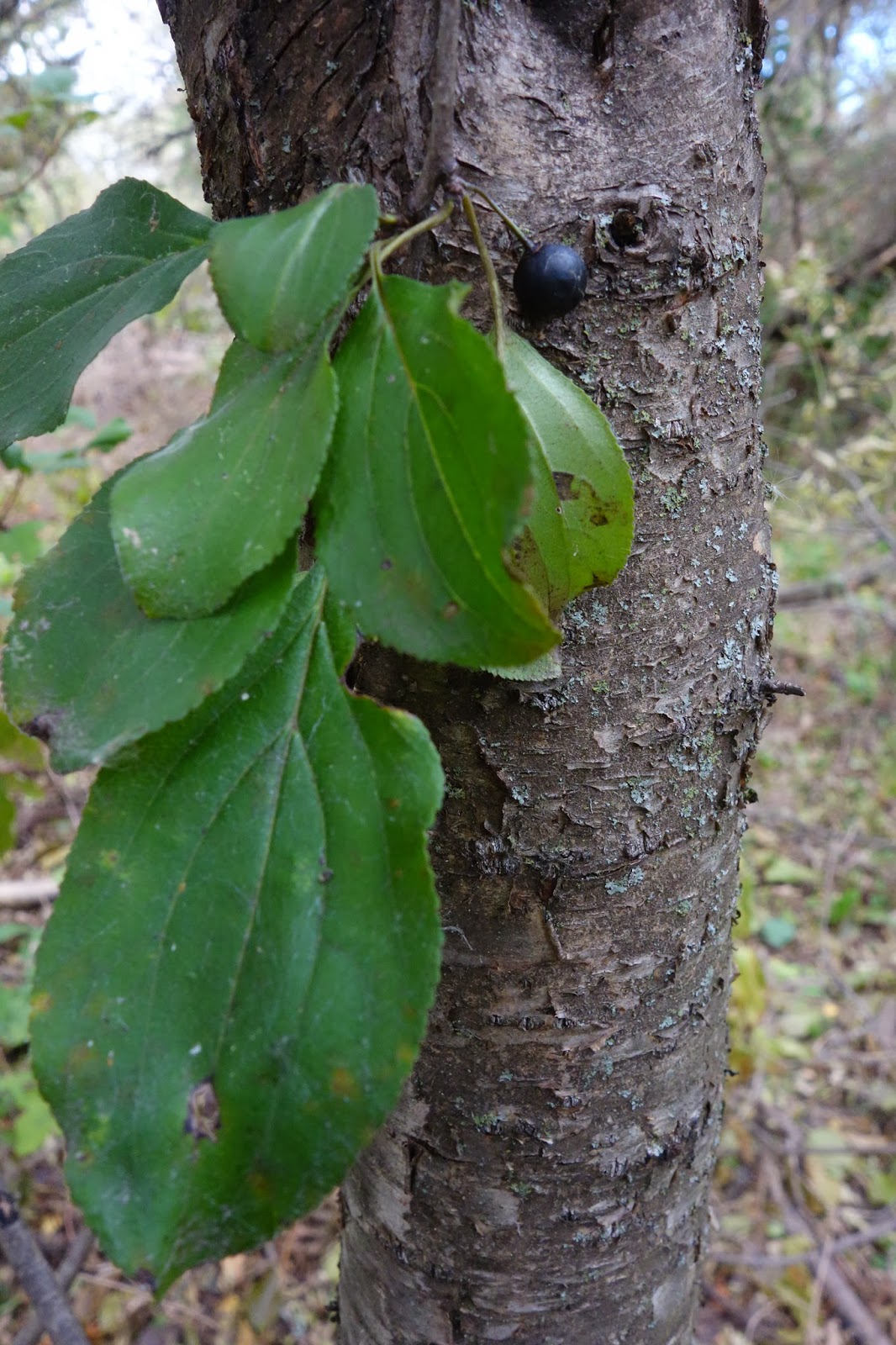

You could say these are "superplants," because they grow faster, and outcompete the native plants. One of the reasons the grow faster is because the insects that eat them don't live here--they are back where the invasives came from--from Europe or Asia.
Invasives crowd out the native plants, and they are not good to eat for the native animals. Buckthorn makes the forest ugly and hard to walk through.
How do burdock and buckthorn spread their seeds?

What would happen if the sanitary sewer leaks? Tree roots are always trying to get into pipes, because... that's where the water is!
#11. The stormwater inlet at Pickford & Arbor Drive
There's a very big stormsewer here--a large square pipe under the street. It has to be big, because it has a large watershed.

Look into the opening. What do you see in there? A lot of leaves?
This stormsewer was rebuilt two years ago. The old storm sewers weren't big enough, because the more we pave the city, the more stormwater there is. And, the pipes wear out.
It heads straight for the lake. Let's follow the path on its left side, all the way to the lake.
#12. Where the Pickford pipe empties into the lake
Stormwater comes out here--it's called "the stormwater outfall." Notice the dry land and plants, in a semicircle beyond the outfall.

As the lake gets more shallow, we say it is getting "older," and less useful to people. All lakes age**, but the pollution that washes in makes them "age" a lot faster.

When the workers finished building this sewer, they left two cans of asphalt inside. They washed out and into the lake... got caught in the ice.
#13. A big cottonwood tree blows over
Everything is changing... all the time. Often change is so slow, that it's hard for us to notice. Lakes become more shallow, because soil and leaves wash in.
Long ago, people changed Lake Wingra by building a dam to make it deeper. They filled some wetlands along it's edge, and dredged lagoons, like the one you skate on by the Zoo.
Then pollution started to make it shallower again. Invasive species arrived, like carp--a big fish that likes muddy water. The springs started to dry up. Invasive aquatic plants spread.
 But some change is natural, and beneficial.
Here, a big tree blew down and fell into the lake.
Its roots dug up a lot of soil, making bare ground and a depression here. It was a place where different plants could grow, because now there was more sun. Different plants growing here means more variety... "biodiversity."
Unfortunately, a buckthorn tree got here first. May invasive plants like disturbed areas.
On the soil still clinging to the tree's roots, you can see a sample of soil brought up from several feet down. The lake bottom used to be right here, because at the end of the ice age, the lake was much bigger. A good deal of the sediment then was a white substance called "lake marl." You can see the white, chalky deposit around the roots of the dead tree.
#14. Another stormwater outfall
We continue east along the shore. Just before the boathouse, we see another big, square pipe.
 This pipe is smaller, because it drains a smaller watershed.
There is no delta here, because the lake was dredged in 2008. The mud dumped by the pipe here was up to four feet deep, before it was removed.

The other pipe with the delta (#13) drains the hilly golf course. There is a lot of erosion happening up in the hilly woods, where runoff runs fast, because of the slope. The faster water flows, the more mud it can carry.

#15. Boat ramp at Vilas Park
Here, you can see a lot of leaves getting into the lake. There aren't any shrubs here along the shore.
 When you have shrubs and other plants, they catch the leaves before they can blow into the lake. The leaves decompose along the shore, and make fertilizer for healthy shore plants. The plants along the shore keep the "fertilizer"--the nutrients--out of the lake.
Plants along the shore also protect the banks from erosion. They make the shore more beautiful, and better for fish.
A shore with lots of vegetation is VERY important for a healthy lake. But everyone wants to get close to the water, so you have to protect the shore with fences, or other ways to keep people on a path.
 #16. Route of the stormsewer
You can see a raised line across the park.
This is the buried stormsewer that dumped into the lake at stop #14.
Stormsewer inlets in the parking area lead to this buried pipe, then to the lake. All the leaves, oil, garbage, and dog waste in the parking area goes right to the lake.
The Friends of Lake Wingra wanted the parking area to send stormwater to a rain garden. The rain garden would cleanse the runoff.
The City Engineers decided not to follow our advice. Building a big rain garden is more complicated and expensive than paving, and they have to worry about who will care for the garden.
#17. Construction, corner of Knickerbocker & Arbor
As we said before, construction causes 19% of the weeds* in our lakes. That's because when it rains, runoff carries mud from construction sites to the lake. The nutrients in mud make the water plants grow fast and thick.
 There are special laws to reduce the amount of mud that gets out of construction sites. The builders are supposed to...

#18. The parking lot at Bluephie's Diner
 Find a stormsewer inlet in the parking area.
 Keeping garbage lids closed is a basic rule for health. It keeps rats, seagull, raccoons, and flies away. And, who wants to swim in "garbage tea?"
* I said 19% of the weeds were caused by construction. Actually, what scientists measured was phosphorus, a very powerful fertilizer. Since mud carries phosphorus to the lakes, and phosphorus causes weed grown, it's fair to say roughly 19% of the weeds were caused by construction mud.
**
Everything is changing... all the time. Often change is so slow, that it's hard for us to notice. Lakes become more shallow, because soil and leaves wash in.
Long ago, people changed Lake Wingra by building a dam to make it deeper. They filled some wetlands along it's edge, and dredged lagoons, like the one you skate on by the Zoo.
Then pollution started to make it shallower again. Invasive species arrived, like carp--a big fish that likes muddy water. The springs started to dry up. Invasive aquatic plants spread.
 But some change is natural, and beneficial.
 Here, a big tree blew down and fell into the lake.
Its roots dug up a lot of soil, making bare ground and a depression here. It was a place where different plants could grow, because now there was more sun. Different plants growing here means more variety... "biodiversity."
Unfortunately, a buckthorn tree got here first. May invasive plants like disturbed areas.
On the soil still clinging to the tree's roots, you can see a sample of soil brought up from several feet down. The lake bottom used to be right here, because at the end of the ice age, the lake was much bigger. A good deal of the sediment then was a white substance called "lake marl." You can see the white, chalky deposit around the roots of the dead tree.
#14. Another stormwater outfall
We continue east along the shore. Just before the boathouse, we see another big, square pipe.

There is no delta here, because the lake was dredged in 2008. The mud dumped by the pipe here was up to four feet deep, before it was removed.

Photo thanks to David Liebl.
The other pipe with the delta (#13) drains the hilly golf course. There is a lot of erosion happening up in the hilly woods, where runoff runs fast, because of the slope. The faster water flows, the more mud it can carry.

#15. Boat ramp at Vilas Park
Here, you can see a lot of leaves getting into the lake. There aren't any shrubs here along the shore.

Plants along the shore also protect the banks from erosion. They make the shore more beautiful, and better for fish.
A shore with lots of vegetation is VERY important for a healthy lake. But everyone wants to get close to the water, so you have to protect the shore with fences, or other ways to keep people on a path.
 #16. Route of the stormsewer
You can see a raised line across the park.
This is the buried stormsewer that dumped into the lake at stop #14.
Stormsewer inlets in the parking area lead to this buried pipe, then to the lake. All the leaves, oil, garbage, and dog waste in the parking area goes right to the lake.
The Friends of Lake Wingra wanted the parking area to send stormwater to a rain garden. The rain garden would cleanse the runoff.
The City Engineers decided not to follow our advice. Building a big rain garden is more complicated and expensive than paving, and they have to worry about who will care for the garden.
#17. Construction, corner of Knickerbocker & Arbor
As we said before, construction causes 19% of the weeds* in our lakes. That's because when it rains, runoff carries mud from construction sites to the lake. The nutrients in mud make the water plants grow fast and thick.

- Put up barriers to prevent muddy water from escaping. "Silt socks," or "silt fences."
- Put a lot of gravel at the entrance.
- Sweep the street at the end of every work day.
- Put black filters on the stormwater inlets, to catch big pieces of dirt. These filters are supposed to be kept clean.
But builders often ignore the rules. And the City does not enforce the rules very well.
Do you see any mud or dirt escaping this site?
Do you see tracks on the street?

 Find a stormsewer inlet in the parking area.
Do you see anything in the parking area that might wash into the lake?
Let's look behind the fence where the garbage dumpsters are kept. The lids of several dumpsters are open. When it rains, the water gets in and makes "garbage tea." Then it leaks out, and gets into the stormsewer.

So you see, when we keep our city clean and healthy, the lake is clean an healthy !
A good deal of the litter, waste, and dirt we make, ends up in the lake.
The lake is a mirror... it reflects how we live.


# # #
* I said 19% of the weeds were caused by construction. Actually, what scientists measured was phosphorus, a very powerful fertilizer. Since mud carries phosphorus to the lakes, and phosphorus causes weed grown, it's fair to say roughly 19% of the weeds were caused by construction mud.
**
Terms used
Runoff
Stormwater
Stormwater inlet
Stormsewer
Sanitary sewer
Headwaters
Terrace
Toxic
Impervious surface
Groundwater
Burial mounds
Invasive species
Delta
Sediment
Nutrient
Fertilizer
Outcompete
Lake marl
Biodiversity
Filter
Silt socks
Silt fences
Rain garden
Resources
The wider watershed--Satellite photo of Madison's lakes
View Wisconsin from space, as seen today (you need to zoom in)
Map of Lake Wingra watershed
Ten Views of Lake Wingra (historical photos)
Map of Madison's stormsewers (also shows lake watershed boundaries)
Photos of important things happening in the watershed

Leaves washing down stormsewer, during big storm. Put your leaves up on the terrace !


.jpg)


No comments:
Post a Comment